

Hyde County is more water than land — of its 1,459 square miles, better than half is sound, marsh, canal and one very large lake. That geography is why a shallow, food-rich shoreline around what is now Lake Mattamuskeet supported a settled Native American community long before any English precinct existed here, and why the water itself, not a town or a highway, has always been the thing this county is organized around.
to 1701 The Mattamuskeet People
The lake and the county both carry a name that predates any European surveyor. It comes from the Mattamuskeet, also recorded as the Machapunga, an Algonquian-speaking people who lived along this shoreline at the time of first English contact in the 1580s. By 1701, the English explorer and surveyor John Lawson — traveling through the region and later publishing his own firsthand account of the Carolina backcountry — recorded that the Mattamuskeet had already been reduced to a single village bearing the lake's name, with roughly thirty warriors, putting the total population well under a hundred people1. Lawson's is the closest thing to a firsthand colonial-era record this county has of the people it was named after by association, not honor.
What happened next is documented mostly in land records, not narrative. After the Tuscarora War (below), remnant Mattamuskeet families received a reservation of roughly 36 square miles of marshland near the lake. In 1724 two tribal leaders, John Squires and John Mackey, petitioned colonial authorities for a formal grant; it was approved in 1727 for 10,240 acres, though the survey that would have made it legally exact was never carried out. Land sales chipped at the reservation starting as early as 1731, and the whole of what remained was sold in 1792 for £50 to a white settler, signed by four adult women and three children — the last Mattamuskeet landholding of record2. By the early 1800s, remaining descendants were recorded in census documents as "free persons of color," several apprenticed out to white households. Several Hyde County families today — Collins, Barber, Chance, Clayton, and Bryant among them — trace their ancestry to the Mattamuskeet.
1705 Wickham Precinct
English colonial government arrived here on December 3, 1705, when this ground was organized as Wickham Precinct — one of three original precincts of Bath County, alongside Pamptecough and Archdale3. The name honored Governor John Archdale's family home, Temple Wycombe, in Buckinghamshire, England — a name with nothing to do with the ground it was stamped onto, which was the norm for a precinct laid out by an absentee governor's clerk rather than by anyone who had actually walked the shoreline.
The water itself, not a town or a highway, has always been the thing this county is organized around.
1711–1739 War, a Governor, a County
Wickham Precinct's name lasted seven years, and the reason it changed says more about colonial North Carolina's instability than about the man it changed to honor. At dawn on September 22, 1711, Tuscarora and allied warriors attacked settlements along the Neuse and Pamlico Rivers, killing at least 140 colonists and opening what became North Carolina's bloodiest colonial conflict, the Tuscarora War4. Edward Hyde, a cousin of King James II's first wife, took office as North Carolina's first governor separate from South Carolina in January 1712 — arriving into a colony simultaneously fighting the Tuscarora and recovering from Cary's Rebellion, an internal political revolt against his own predecessor. Hyde had almost no army of his own to work with: resentment left over from the Rebellion and a Quaker refusal to bear arms or even lend them left him appealing to Virginia and South Carolina for military help.
South Carolina forces and their Native allies defeated the Tuscarora and negotiated a peace early in 1712, but the North Carolina assembly never recognized the treaty and the war resumed by summer. Hyde himself didn't live to see how it ended. He died of yellow fever on September 8, 1712, in Chowan Precinct — governor for barely eight months5. Later that same year, the precinct that had briefly been Wickham was renamed in his honor. Bath County was dissolved in 1739, and Hyde Precinct became Hyde County outright — a name that has now outlasted the man it honors by more than three centuries, even though he governed for well under a year of it.
1820s–1849 Swan Quarter & the Villages
Hyde County's county seat moved once before it settled. Lake Landing held the role starting in 1820, with a courthouse built there; Swan Quarter took it over in 1836, and has held it ever since. The town's name has nothing to do with waterfowl — it's a shortening of "Swann's Quarter," after Samuel Swann, whose eighteenth-century settlement sat along Pamlico Sound near Swan Bay. The current Hyde County Courthouse was built in 1854–1855 and was added to the National Register of Historic Places on May 10, 1979 (reference #79001726)6. Swan Quarter has carried three jobs at once for a very long time now — county seat, and, since 1977, the mainland ferry terminal to Ocracoke Island (below) — and it has never been a large town while doing any of them; the 2020 census counted 275 residents.
The other mainland communities each have their own real history, not interchangeable footnotes to Swan Quarter's. Fairfield, on the north side of the lake, has a founding story carried on a tombstone rather than a deed: it credits David Carter Jr. with having reclaimed "Fairfield from swamps and left it a garden," though the Hyde County Historical Society's own published county history notes the claim's historical precision is uncertain7. What's better documented is the Fairfield Canal, which by the turn of the twentieth century — under Capt. Flave Spencer's ownership — was charging two cents a bushel for beans and corn and two dollars for fertilizer, moving goods to Elizabeth City and Norfolk on a roughly week-long run before truck transport made the canal obsolete. At its peak, Fairfield Township and its surrounding communities held around 1,100 people, with nine stores and a hotel in the village itself. The Fairfield Historic District — 54 contributing buildings, largely Italianate and Carpenter Gothic — was listed on the National Register on July 5, 1985 (reference #85001448)8.
Sladesville, on the county's southern side, was formally incorporated as a town on January 27, 1849, and stayed incorporated for most of a century before reverting to unincorporated status by the 1940 census9. Scranton, along the Pungo River northwest of Swan Quarter, was never incorporated at all; it and Sladesville together anchored the county's commercial timber holdings — cypress, gum and pine — that a 1976 county land-use survey still found concentrated in that same stretch of the county decades after the boom years had passed. Engelhard, on Far Creek off Pamlico Sound, has been the county's working fishing port throughout — shrimp, blue crab and finfish moved through it then and now, and Gibbs Store, a general-merchandise business there, has operated continuously for close to a century.
1909–1926 Draining the Lake
For a stretch of the early twentieth century, developers didn't believe Lake Mattamuskeet should exist. The North Carolina legislature authorized the Mattamuskeet Drainage District in 1909, and large-scale drainage operations began in 1914, run by a company that named its planned farming community New Holland after the Dutch reclamation projects it was consciously imitating. The pumping station built to do the work in 1911 was, at the time, the largest pumping plant in the world, rated to move an estimated 1.2 million gallons a minute out of the lake and into Pamlico Sound10.
Developers bet the lakebed would make better farmland than lake. The bet failed twice.
It didn't work — not once, but repeatedly. Between 1916 and 1926, the lake was drained and reclaimed as farmland three separate times, and each time nature reasserted itself. The costs were real and the natural difficulties genuine; by the mid-1920s, the drainage project had run its course.
1934–Present A Refuge Economy
In 1934, the U.S. government acquired the lake and roughly 50,000 surrounding acres, establishing what is now Mattamuskeet National Wildlife Refuge. The old pump station itself was remodeled that same year into a 38-room hotel and headquarters building — the Mattamuskeet Lodge — and was listed on the National Register of Historic Places on May 28, 1980 (reference #80002849)11.
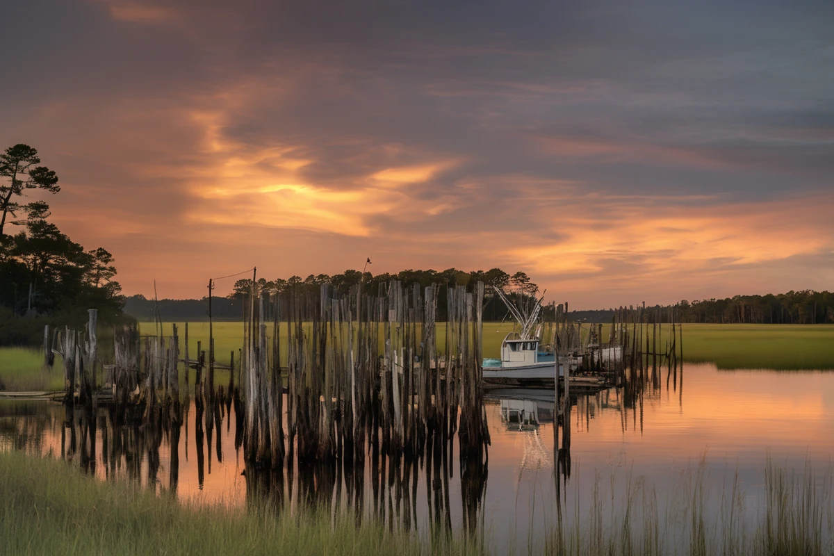
With the lake settled as a refuge rather than farmland, the county's economy organized around what the land and water actually supported. Soybean and corn agriculture took root on the drained ground at the lake's margins; commercial fishing continued out of Engelhard and Swan Quarter, landing shrimp, blue crab, and finfish that still support year-round working livelihoods. Hunting followed the wildlife the refuge system now protected — Mattamuskeet's wintering waterfowl, along with deer, bear, and small game across the county, built the hunt economy that still runs through Hyde County real estate today, not as a seasonal sideline but as a genuine part of how land here gets valued and sold.
Separate Market Ocracoke: A Different County Line
Ocracoke Island carries the Hyde County name on the tax rolls, but it functions as an entirely separate market, and this site treats it that way deliberately rather than folding it into the mainland listing grids. The two halves of the county weren't even directly connected by ferry until relatively recently: the North Carolina Ferry Division was formed in 1974, and the Swan Quarter–Ocracoke route — the last route added to the state system — didn't begin service until 1977, finally giving island residents a direct link to their own county seat12. A 2.5-hour crossing of open Pamlico Sound is not a commute, and Ocracoke's history, market, and buyer profile get their own dedicated coverage elsewhere on this site rather than a rushed paragraph here.
Present The County Today
Hyde County's population peaked in 1900 at 9,278 and has been declining, in fits and starts, ever since — 4,589 people at the 2020 census, a 21 percent drop from 2010 alone, among the steepest percentage declines of any county in the state13. The county is confirmed Tier 1 — North Carolina's most economically distressed designation — for 2026 under the state Department of Commerce's annual rankings14. There is still no incorporated town of significant size anywhere on the mainland; Swan Quarter, Engelhard, Fairfield, Scranton, and Sladesville are the working villages, exactly as they were a century ago, just smaller. What hasn't declined is the reason people still come: a defining natural refuge, a working hunt-and-fishing economy, and a scale of quiet that a shrinking population only deepens. That combination is what makes Hyde County unlike anywhere else in this brokerage's territory — not a modern marketing frame, but the same set of facts this whole history keeps landing back on.
Primary Sources & Further Reading
The State Library of North Carolina's encyclopedia project. Source for the county's precinct-formation date, naming history, and geography.
NC State Historic Preservation Office / National Register of Historic Places
Listing dates and reference numbers for the Hyde County Courthouse, the Fairfield Historic District, and the Lake Mattamuskeet Pump Station (Mattamuskeet Lodge).
Hyde County Historical & Genealogical Society
Source for Fairfield's founding legend, the Fairfield Canal's tolls and operation, and village-level detail not in state-level references, drawn from the Society's own published Hyde County History (1976).
David La Vere, The Tuscarora War
University of North Carolina Press, 2013 — the fullest single academic monograph on the 1711 Tuscarora War and its regional aftermath.
Sources consulted for this page include NCpedia (the State Library of North Carolina's peer-reviewed encyclopedia project), National Register of Historic Places listing data for Hyde County's four contributing properties referenced above, the Hyde County Historical & Genealogical Society's published county history, David La Vere's academic monograph on the Tuscarora War, John Lawson's 1701 firsthand account of the Carolina backcountry as summarized in NCpedia's entry on the Mattamuskeet people, U.S. Census Bureau population data, and the NC Department of Commerce's 2026 county tier rankings. Numbered citations for specific claims appear below. Wikipedia was used only to cross-check dates and figures already established by the sources above, never as the sole source for a factual claim. Dates and figures are stated as found; where a claim's precision is genuinely uncertain in the underlying source (Fairfield's founding legend, for instance), this page says so rather than presenting it as settled fact.
- John Lawson's 1701 firsthand observation that the Mattamuskeet had been reduced to a single village of roughly thirty warriors, following the Mattamuskeet (also Machapunga) people's documented presence on this shoreline since first English contact in the 1580s, as summarized in NCpedia's entry on the tribe. NCpedia, "Mattamuskeet American Indian Tribe," ncpedia.org/mattamuskeet-indians. ↩
- The Mattamuskeet reservation's 1724 petition, 1727 land grant of 10,240 unsurveyed acres, land sales beginning 1731, and the final 1792 sale for £50, per NCpedia's entry on the tribe (as above). ↩
- Wickham Precinct's organization on December 3, 1705, as one of three original precincts of Bath County, and its naming for Governor John Archdale's English family home, per NCpedia's Hyde County geography entry. NCpedia, "Hyde County," ncpedia.org/geography/hyde. ↩
- The September 22, 1711 Tuscarora War attack and its scope (at least 140 colonists killed) per David La Vere, The Tuscarora War: Indians, Settlers, and the Fight for the Carolina Colonies (Chapel Hill: University of North Carolina Press, 2013) — the fullest academic monograph on the conflict. ↩
- Edward Hyde's January 1712 appointment as North Carolina's first separate governor, Cary's Rebellion, his appeals to Virginia and South Carolina for military help against the Tuscarora, and his death from yellow fever on September 8, 1712, in Chowan Precinct after under eight months as governor, per NCpedia's biographical entry. NCpedia, "Hyde, Edward," ncpedia.org/hyde-edward. ↩
- Lake Landing serving as county seat from 1820 and Swan Quarter taking over in 1836; the Hyde County Courthouse's 1854–1855 construction date and its May 10, 1979 National Register listing (reference #79001726), per NC SHPO/National Register documentation, cross-checked against the Wikipedia-maintained summary. ↩
- Fairfield's founding legend crediting David Carter Jr., the Fairfield Canal's toll schedule under Capt. Flave Spencer, and the village's peak population, per the Hyde County Historical & Genealogical Society's published Hyde County History (1976), as reproduced at ncgenweb.us/hyde/photosbios/places/fairfield.htm — which itself notes the founding legend's precision is uncertain, a caveat this page preserves rather than resolves. ↩
- The Fairfield Historic District's July 5, 1985 National Register listing (reference #85001448) and its 54 contributing buildings, per NC SHPO/National Register documentation, cross-checked against the Wikipedia-maintained summary. ↩
- Sladesville's incorporation on January 27, 1849 and its reversion to unincorporated status by the 1940 census, per the Wikipedia-maintained summary of available county and census records. ↩
- The 1909 Mattamuskeet Drainage District authorization, the 1911 pump station's rated capacity (roughly 1.2 million gallons per minute), and the "New Holland" name, per NCpedia's Lake Mattamuskeet entry. NCpedia, "Lake Mattamuskeet," ncpedia.org/lakes/lake-mattamuskeet. ↩
- The 1934 federal acquisition establishing Mattamuskeet National Wildlife Refuge, the pump station's 1934 conversion to the 38-room Mattamuskeet Lodge, and its May 28, 1980 National Register listing (reference #80002849), per NC SHPO/National Register documentation, cross-checked against the Wikipedia-maintained summary. ↩
- The North Carolina Ferry Division's 1974 formation and the Swan Quarter–Ocracoke route's 1977 start of service, the last route added to the state system, per the Wikipedia-maintained history of the NC Department of Transportation Ferry Division. ↩
- Hyde County's 1900 population peak of 9,278, its 2020 population of 4,589, and the 21 percent decline from 2010 to 2020, per U.S. Census Bureau decennial data as compiled in the county's Wikipedia-maintained profile. ↩
- Hyde County's Tier 1 (most economically distressed) designation for 2026, per the NC Department of Commerce's 2026 County Distress Rankings. NC Commerce, "Commerce Issues 2026 Economic Development Tier Rankings," commerce.nc.gov. ↩